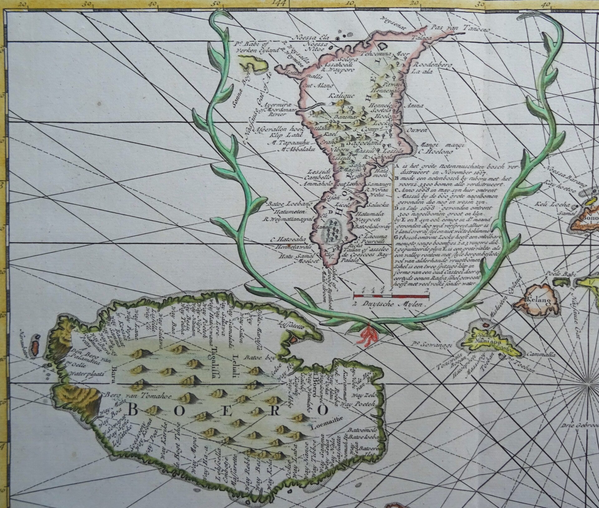
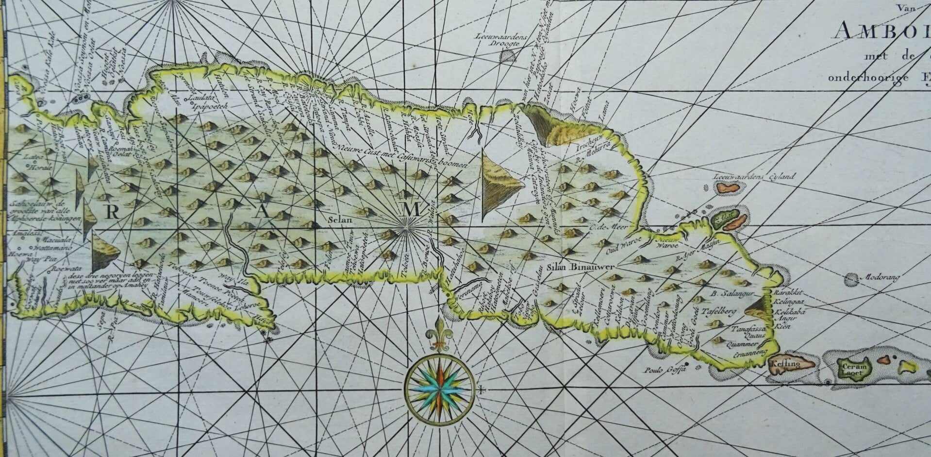
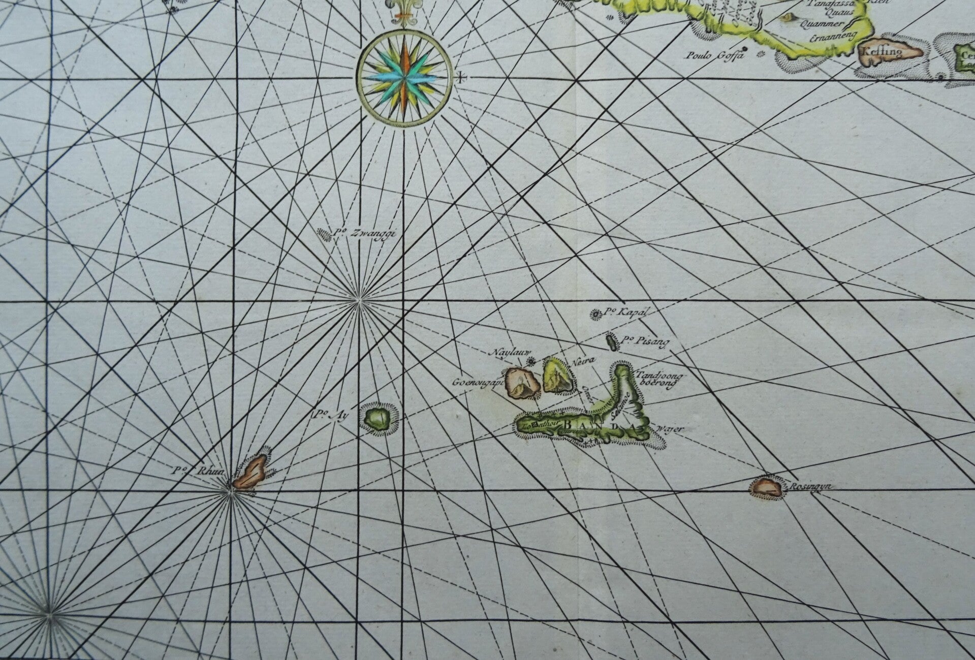
Indonesia, Moluccas – large map on 2 sheets Valentijn / Ottens, 1724, De Landvoogdy van Amboina met de elf onderhoorige Eylanden
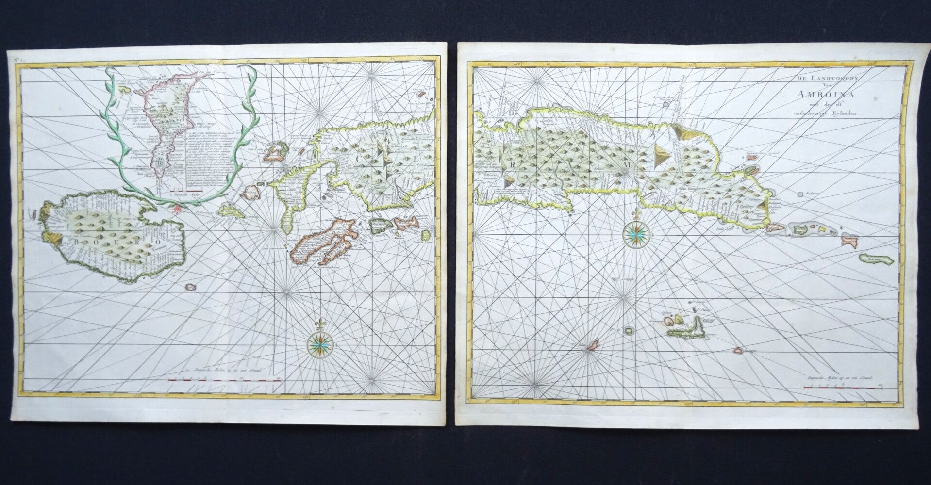
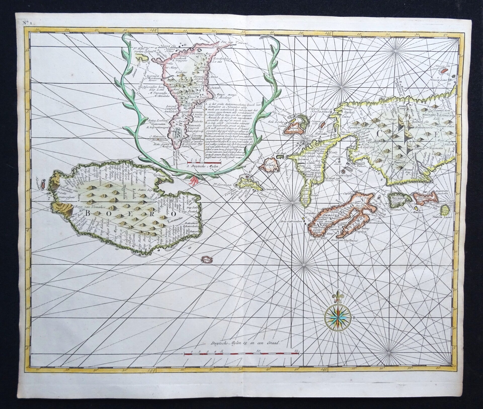
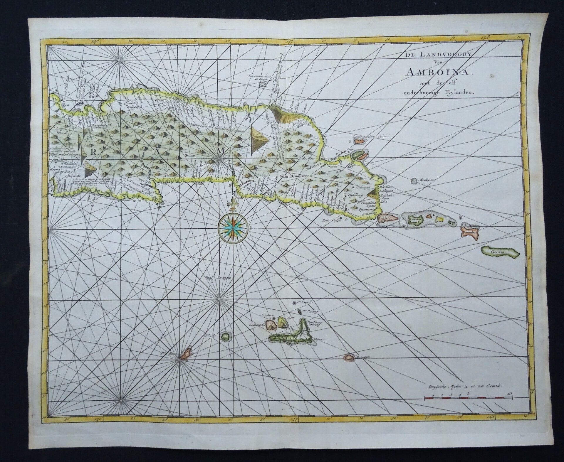
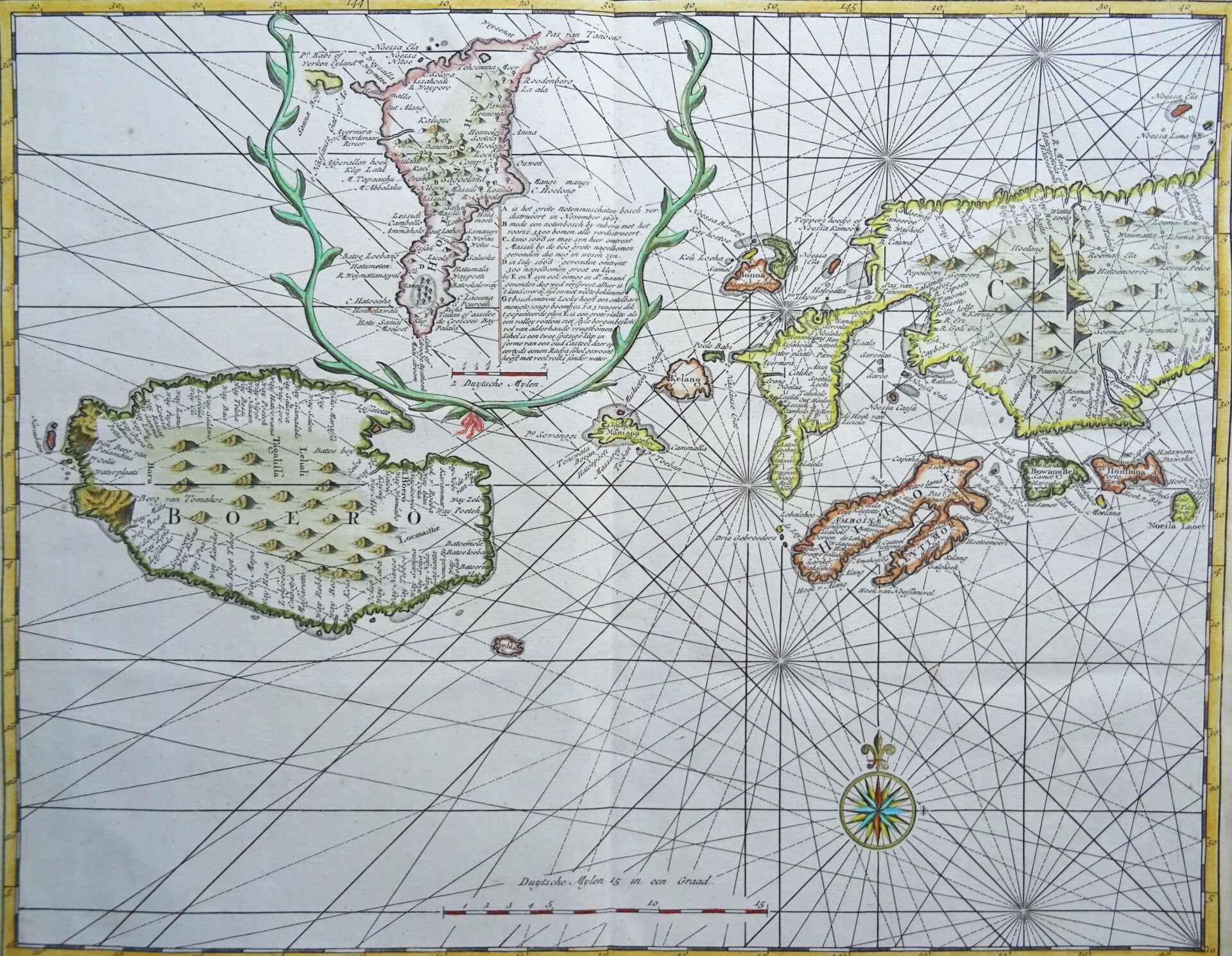


Large copper 18th century engraving on two sheets, engraved by F. Ottens, together forming a nautical chart of the Moluccas islands in Indonesia.
The map shows all eleven islands of the Amboina Province: Ambon, Buru, Ambelau, Manipa, Kelang, Bonoa, Seram, Seram Laoet, and the so called ´Oeliassers´, namely Noessa Laoet, Honimoa, and Boang-Besi.
Published in the book by F. Valentijn: ´Oud en Nieuw Oost-Indien, containing an accurate and extensive treatise of Dutch power in those regions, (...). Second part, description of Amboina, (...), [incl.] Ambon affairs. Dordrecht, etc. J. van Braam and G. onder de Linden, 1724.´
Francois Valentijn was a prominent historian of the Dutch East India Company. He travelled to the East Indies twice and served as a Calvinist minister on Ambon between 1686 and 1694. In preparing this monumental work, he was given privileged access to the previously secret archives of the Dutch East India Company, which contained transcripts and copies of important earlier Dutch documents. travels.
Excellent condition. Crisp, fresh paper, clear print. Central folds as published.
Two sheets forming one large map:
Images 30x37cm, sheets 33x39,5cm