North Africa Dapper/Van Meurs, 1668, Barbaria Biledulgerid o Libye et pars Nigritarum Terra

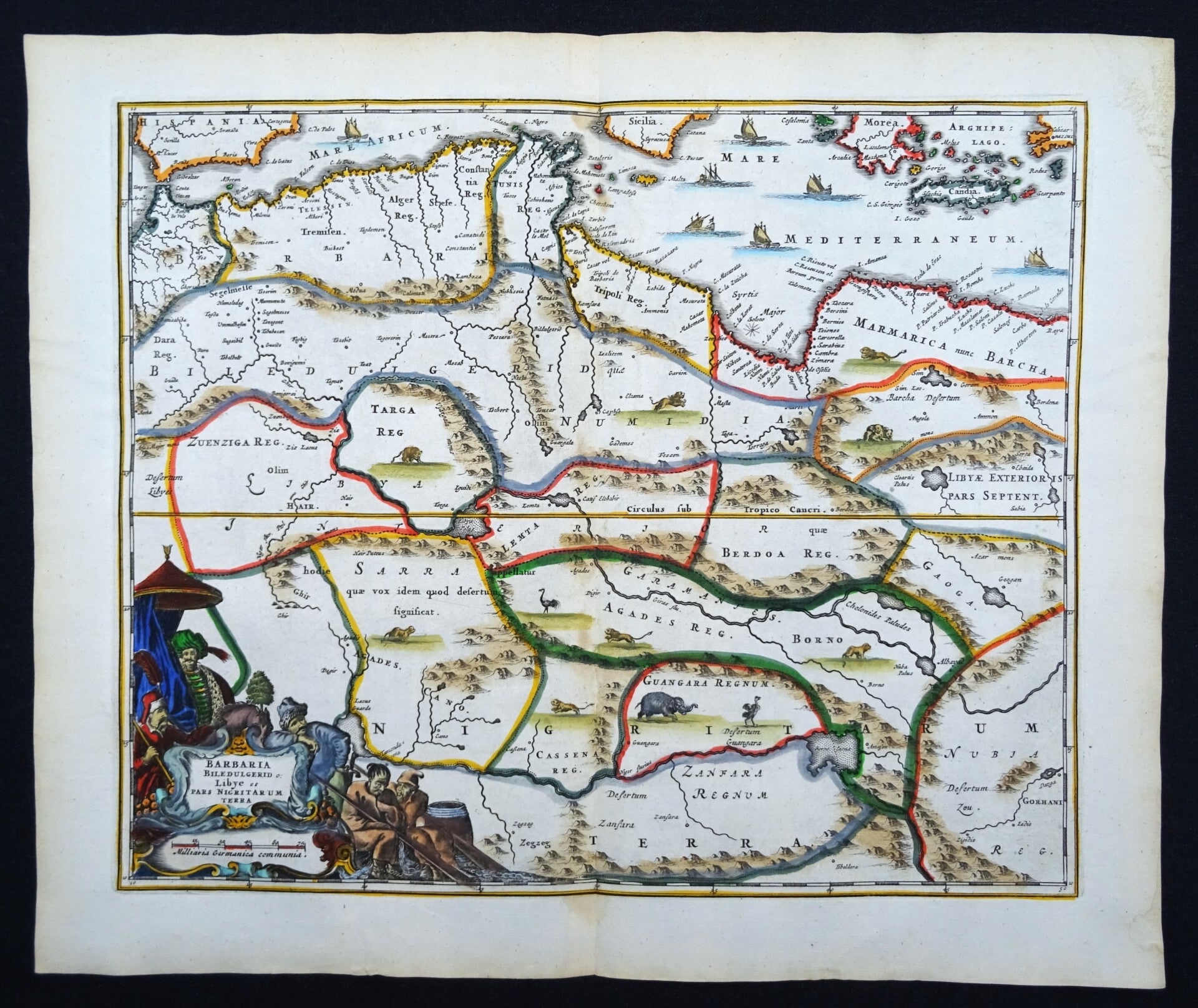


Fine decorative map of the famed Barbary coast extending from Morocco to Libya. Includes much of the western Mediterranean with parts of Sicily, Greece and Crete. Richly engraved with place names, mountains, and numerous imaginary lakes in the Sahara Desert. Adorned with lions, elephants, and ostriches in the interior, ships in the sea, and a title cartouche surrounded by merchants, sailors and slaves.
Published in the 1668 first edition of Olfert Dapper´s "Naukeurige Beschrijvingen der Afrikaensche gewesten en Naukeurige beschrijvinge der Afrikaensche Eylanden", popularly known as ´Description of Africa´.
Olfert Dapper’s ‘Description of Africa’ was an ethnographic book which offered a detailed description of the parts of Africa known to Europeans in the mid-seventeenth century. Despite the work being regarded as one of the most important and detailed seventeenth-century publications on Africa, Dapper himself never actually visited the continent. Instead, he relied on the reports of Jesuit missionaries and Dutch explorers. The ‘Description of Africa’ was first published in 1668 by Jacob van Meurs in Amsterdam
Excellent. Clear print, very wide margins. Central fold, as published. Reverse side blank.
Image 26,5x32,5cm, page 32x38cm